Notebook for this example can be found: Here
Introduction
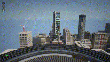
Path planning is an essential component of autonomous drone systems. It allows drones to navigate complex environments while avoiding obstacles. In this tutorial, we’ll use AirGen’s built-in path planning capabilities to generate safe trajectories for our drone.Setting Up the Drone
First, let’s import and initialize our drone in the AirGen environment:AirGenDrone class provides a simplified interface to control aerial vehicles in the simulation.
Taking Off
Before we can plan a path, we need to get our drone airborne:takeoffAsync() method initiates the takeoff sequence, and the .join() call ensures that our code waits until the takeoff is complete before proceeding.

Exploring the Navigation Mesh
AirGen uses a navigation mesh (navmesh) to represent the traversable space in the environment. This mesh defines where the drone can safely fly:Generating Random Destination Points
Now let’s create a function that can sample random valid positions within our navigation mesh:- Calculates the extents of the navigation mesh
- Samples a random position within those bounds
- Generates a random orientation (yaw angle)
- Returns a complete 6-DOF (degrees of freedom) pose
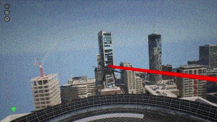
Path Planning to a Random Destination
Now we can plan a path from the drone’s current position to a randomly selected destination:simPlanPath function does the heavy lifting:
- It takes the start and goal positions
- Finds a collision-free path between them
- Optionally smooths the path for more natural drone movement
- Can visualize the path in the simulation (when
draw_path=True)
6. Following the Planned Path
Finally, we need to convert the planned path into a format suitable for the drone’s control system and command the drone to follow it:moveOnPathAsync method takes several parameters:
points: List of waypoints defining the pathvelocity: Desired speed in meters per secondtimeout: Maximum time to wait for completion (in seconds)drivetrain: Control mode for the drone’s movement (ForwardOnlymeans the drone will always face its direction of travel)yaw_mode: Controls how the drone’s heading changes during flight- Lookahead parameters that influence how closely the drone follows the path
.join() call ensures our code waits until the drone completes the entire path.
Understanding Path Planning Parameters
Let’s examine some of the key parameters in more detail:DrivetrainType
ForwardOnly means the drone orients itself in the direction of travel, like an airplane. Alternatively, MaxDegreeOfFreedom allows the drone to move in any direction while maintaining its orientation.
YawMode
The first parameter (is_rate) determines how to interpret the second parameter. When set to False, the second parameter is an absolute yaw angle in radians. When set to True, the second parameter becomes a yaw rate (angular velocity) in radians/second.
Lookahead Parameters
The last two parameters inmoveOnPathAsync control how closely the drone follows the path. A value of -1 uses the default lookahead distance, while the last parameter (set to 0) is the adaptive lookahead factor, where zero means non-adaptive.